New Tampa community leader and baseball legend backs award-winning journalist and civic advocate to succeed Councilman Luis Viera
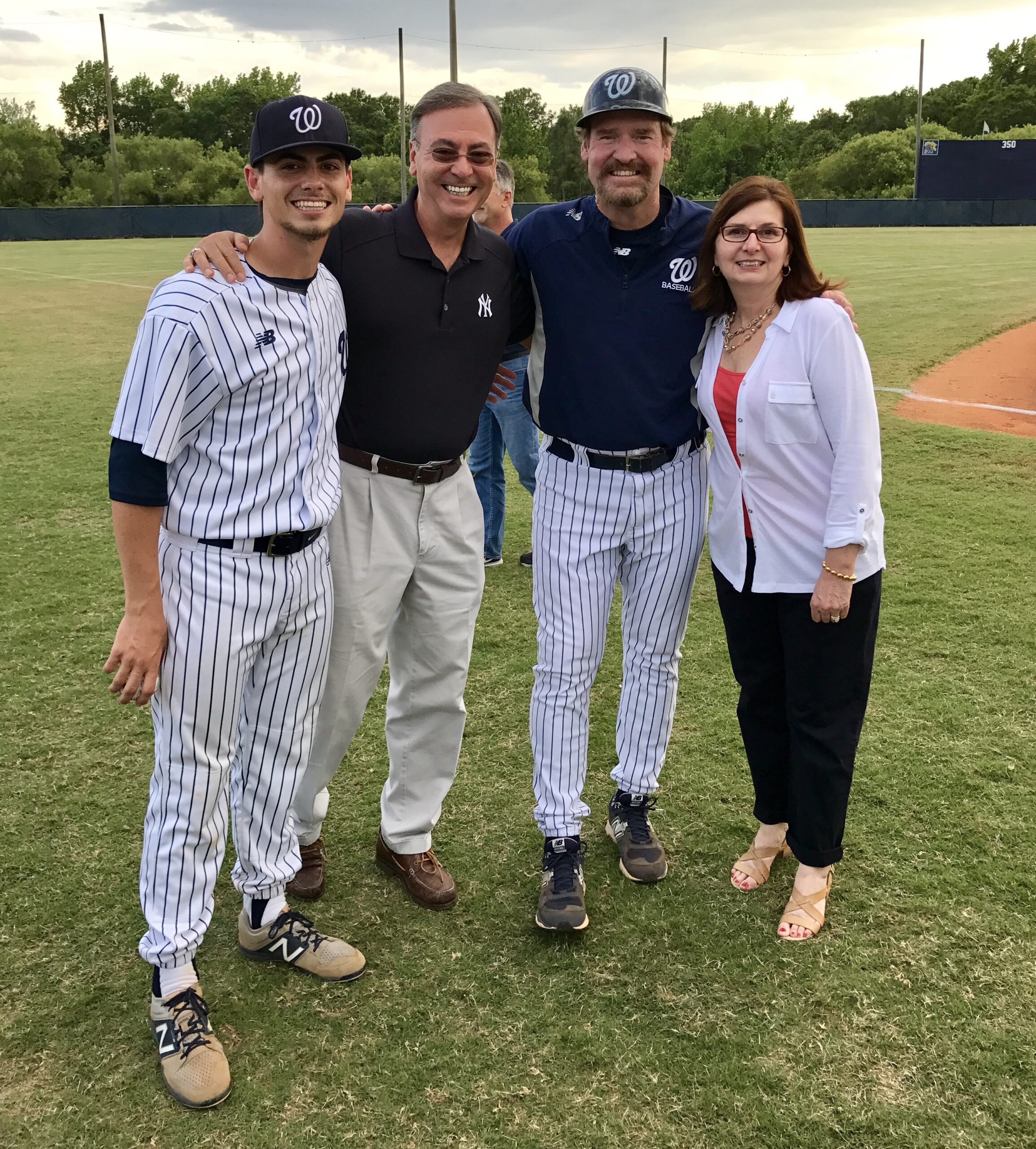
(L.-r.) Aaron & Alan Cohn, Wade Boggs & Alan’s wife Patty Cohn. (Photo provided by Alan Cohn)
TAMPA, Fla. — Baseball Hall of Famer and longtime New Tampa resident Wade Boggs has endorsed Alan Cohn in his campaign for Tampa City Council District 7.
Boggs, one of the most celebrated players in Major League Baseball history, has deep roots in the New Tampa community. In addition to his Hall of Fame career with the Boston Red Sox, New York Yankees, and Tampa Bay Rays, Boggs spent nearly two decades coaching baseball at Wharton High School and remains actively involved in community affairs.
“Alan Cohn has spent his career asking tough questions, standing up for ordinary people, and holding powerful interests accountable,” said Boggs. “Those are exactly the qualities we need on the Tampa City Council. Alan understands our community and will be a strong voice for the residents of District 7.”
Cohn said he is honored to receive Boggs’ endorsement.
“I’m grateful and honored to have Wade Boggs’ support,” said Cohn. “Like me, Wade raised his family in New Tampa and cares deeply about this community. He understands that our neighborhoods need a representative who will fight for the police, fire protection, infrastructure, and city services our residents deserve. He also knows the importance of having someone who isn’t afraid to ask tough questions, get answers, and hold government accountable.”
District 7 stretches from New Tampa and North Tampa to Forest Hills and south to the Fowler Avenue corridor.
A Peabody Award and Emmy Award-winning investigative journalist, Cohn spent more than three decades uncovering public corruption, exposing defense contractors that supplied defective military equipment, helping veterans obtain long-overdue benefits, and assisting consumers who were victimized by dishonest businesses.
Cohn currently serves as Vice Chair of Tampa’s Charter Review Advisory Commission. He was nominated by Tampa City Councilmember Luis Viera and appointed by the Tampa City Council.
Councilmember Viera is term-limited and is running for the Florida House of Representatives.
About Alan Cohn
Alan Cohn is an award-winning investigative journalist, community advocate, and Vice Chair of Tampa’s Charter Review Advisory Commission. He is a candidate for Tampa City Council District 7, representing neighborhoods from New Tampa to Forest Hills. For more info, visit AlanCohnforTampa.squarespace.com/
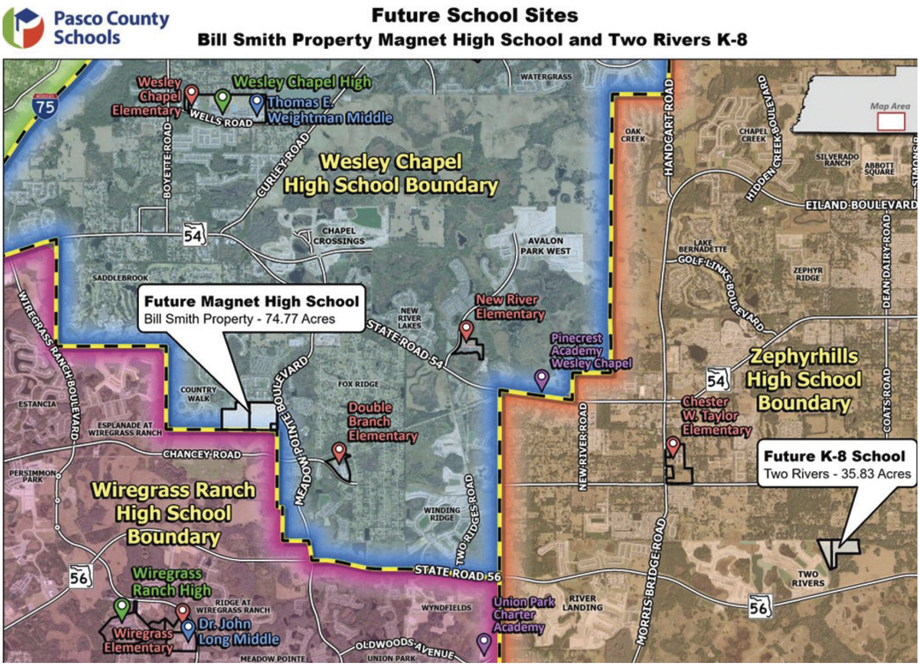
This map shows the planned location for the future magnet high school off Meadow Pointe Blvd., as well as the location of the future K-8 school planned for the Two Rivers community. (Image credit: Pasco County Schools)
It’s still a couple of school years away, but Wesley Chapel will welcome another high school to address overcrowding concerns at two of its high schools — as well as help grow the area’s healthcare workforce.
Set to open in August 2028, the new school will be a medical magnet high school with an opening-day capacity of 1,300 students and a heavy focus on health care and medical studies, including medical sciences, imaging and nursing.
Located on the west side of Meadow Pointe Blvd., north of Chancey Rd. (between C.R. 54/ Wesley Chapel Blvd. and S.R. 56; see map), the nearly 75-acre site is close to numerous hospitals, including AdventHealth Wesley Chapel, BayCare Hospital Wesley Chapel and especially, the coming-soon Florida Medical Clinic Orlando Health Wiregrass Ranch Hospital.
“We believe the market in that area would lend itself to that career cluster,” said Pasco County Superintendent of Schools John Legg, Ed.D., at the Sept. 9, 2025, Pasco School Board workshop regarding the proposed magnet school.
With it being situated between Wesley Chapel (WCH) and Wiregrass Ranch (WRH) high schools, the new school is expected to pull most of its student population from those currently attending WCH and WRH, both of which are over capacity. WCH is currently about 500 students over its capacity and WRH is 600- 700 students over its capacity.
The new school is part of a broader effort by the Pasco School District to partner with healthcare organizations and hospitals in order to expand the county’s healthcare workforce.
In 2025, the district received a $500,000 planning grant from Bloomberg Philanthropies, in partnership with AdventHealth, to build a healthcare-focused high school program, with an opportunity to secure a larger $25-million, five-year implementation grant in the future. We had no further information about that additional grant at our press time.
The school district also has a great partnership with Pasco Hernando State College (PHSC) through its nursing and health science programs. PHSC officials believe that this new magnet school will be a tremendous benefit to Pasco’s health care industry, as well as its residents.
“We are proud to support the new medical magnet high school and help create a seamless pathway for students with an interest in health care to advance into our nursing and allied health programs,” says PHSC President Eric Hall, Ed. D. “This partnership aligns with our commitment to preparing the next generation of health care professionals and complements the expanded educational opportunities available through our Institute for Nursing and Allied Health Advancement at [PHSC’s] Porter Campus at Wiregrass Ranch.”
District officials say the approximately $80-million school is primarily being funded by impact fees, which are one-time charges imposed by local municipalities on new residential developments in order to fund public projects like schools and infrastructure.
We hope to be able to update this story within the next few months.
Harmon Ashton Oaks’ ‘Build-To-Rent’ Townhomes & Two Ridges Rd. Will Each Flank Established Community
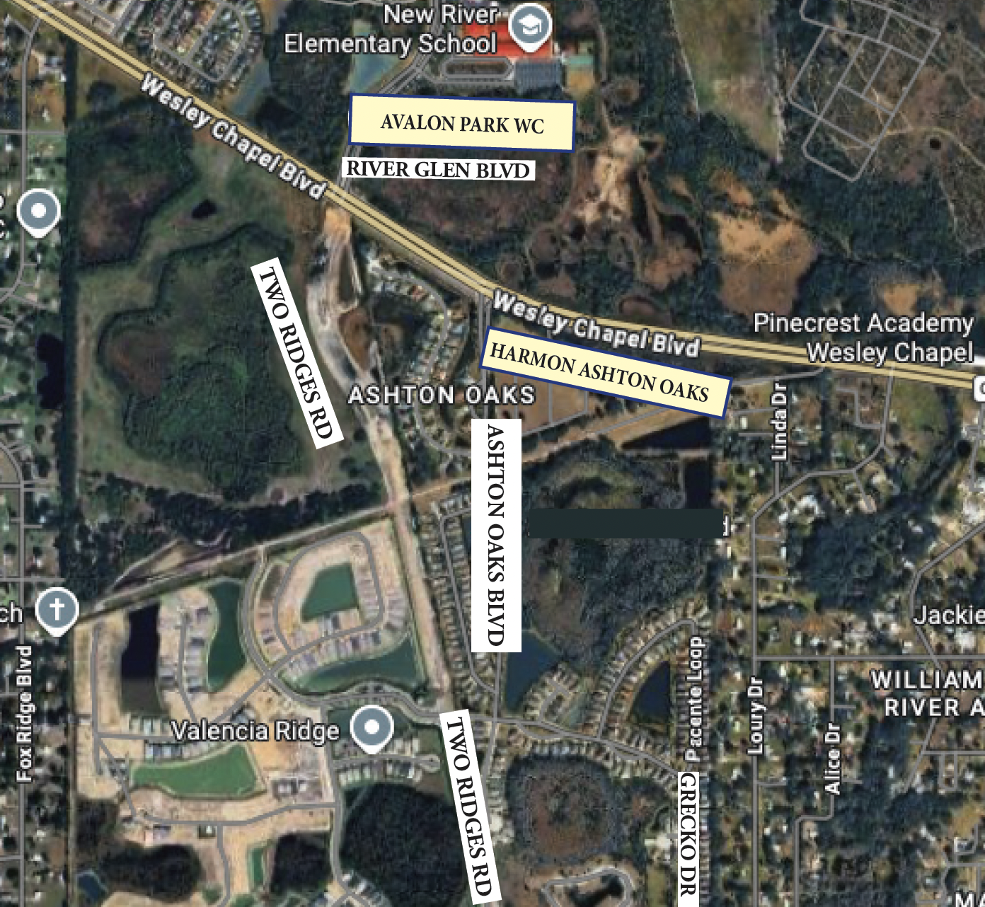
The Google map above has been modified by Neighborhood News to show the locations of the portion of Two Ridges Rd. now under construction (upper Two Ridges Rd. label) & Harmon Ashton Oaks.
Development to the left, development to the right. It doesn’t take a genius to understand that Wesley Chapel is one hot area, quickly being shaped by one project after another, and the residents of the Ashton Oaks community off C.R. 54/Wesley Chapel Blvd. are seeing that first-hand — as their small neighborhood of 203 single-family homes and 70 villas is literally being surrounded on all sides by new construction.
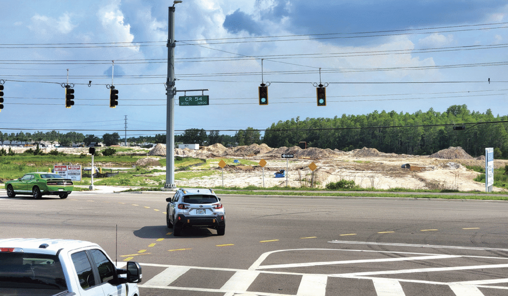
About 1.5 miles east of Meadow Pointe Blvd. along C.R. 54 (which was called S.R. 54 until recently, when Pasco County took over the responsibility for the road from the state), two major projects are currently moving full steam ahead, flanking the established Ashton Oaks neighborhood and bringing both long-awaited infrastructure improvements and new residential growth to the area.
Two Ridges Rd. Extension Moving In The Right Direction
The first project will likely be something of a major relief for many Ashton Oaks residents, who have dealt with increasing cut-through traffic ever since the first leg of Two Ridges Rd. (see map) opened in early 2025.
That initial 1.3-mile segment connected S.R. 56 to Grecko Dr., which created a temporary route between C.R. 54 and S.R. 56 for drivers “in the know.” While some residents viewed the shortcut as an unexpected traffic burden, the corridor itself was always envisioned by county planners, long before the first homes in Ashton Oaks were ever built.
Looking south at the intersection of River Glen Blvd. & the new portion of Two Ridges Rd. (Photos by Joel Provenzano)
Now, the northern second leg of Two Ridges Rd. — approximately 0.7 miles in length — is rapidly taking shape (photo right). The extension will run north to the existing traffic signal at C.R. 54 and River Glen Blvd., across 54 from the main entrance to Avalon Park Wesley Chapel.
Crews are currently performing grading, drainage and landscaping work across the corridor, steadily preparing the site for curbs, paving and final roadway construction.
At the current pace, locals can likely expect the Two Ridges Rd. construction to be near or fully completed by the end of 2026.
Once finished, the new extension will become the southern leg of the existing C.R. 54/ River Glen Blvd. intersection, opening access to future development opportunities on the southwest corner of the intersection, including a planned commercial parcel and the anticipated second phase of the nearby Valencia Ridge 55+ community (again, see map).
According to county records, GL Homes — the developer of Valencia Ridge — is funding and constructing the extension of Two Ridges Rd. using developer dollars.
Beyond local traffic improvements, the project also represents another major step toward the completion of a larger regional north-south corridor first detailed in our “…Road with (Too) Many Names?!” article nearly two years ago.
That corridor, pieced together through multiple separately named roadway segments, is now quickly becoming reality:
• 100% of the K-Bar Ranch Pkwy. segment in New Tampa is currently under construction
• Approximately 90% of the Wyndfields South segment is under construction
• Roughly 50% of Vida’s Way has already been completed (with the other 50% to start along with a future phase)
However, one major section of this road with too many names will no longer move forward. As we reported last year, the entire Kirkland Ranch portion of the corridor was sold to the state for conservation purposes, removing that segment from future roadway plans.
Most of the roadway sections are being constructed privately by developers as part of their associated communities. The only publicly funded portion currently planned is the southernmost 10% of Wyndfields South, the section along the west side of Union Park Charter Academy, which is slated for completion by Pasco County.
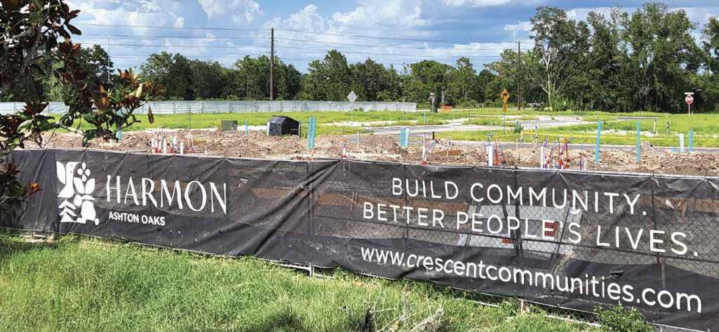
Harmon Ashton Oaks Brings Build-To-Rent Trend To C.R. 54
The second major project under way, to the east of Ashton Oaks, is Harmon Ashton Oaks (see map above & photos below), the build-to-rent townhome community rising on the southeast corner of C.R. 54 and Ashton Oaks Blvd.
The signage for Harmon Ashton Oaks is visible from C.R. 54.
The 28-acre development will feature direct access from both roadways and represents another example of a rapidly growing housing trend across the Tampa Bay region: professionally managed rental home and townhome communities.
The project is being developed by DRB Group Florida in partnership with Crescent Communities, which has previously developed several apartment communities throughout Florida, including the well-rated Novel Beach Park overlooking Tampa Bay in the Westshore area of Tampa.
However, Harmon Ashton Oaks appears to be Crescent Communities’ first single-family-style rental community in Florida, despite the company already operating similar Harmon-branded communities in North and South Carolina, Texas and Arizona.
Unlike traditional apartments, build-to-rent communities are designed to offer many of the conveniences of apartment living while providing features more commonly associated with single-family homes.
That includes attached garages, private ground-floor patios opening onto lawns, larger floorplans, and increased privacy — all while still offering residents on-site leasing offices, professional property management and lease flexibility.
The concept has become increasingly popular in Wesley Chapel in recent years, joining communities such as Vireo Wesley Chapel in Meadow Pointe III and Skymor Wesley Chapel off the end of Caroline Dr.
According to the developer’s website:
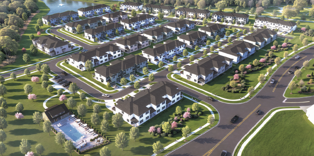
“Designed to blend the freedom of renting with the comfort and privacy of single-family living, Harmon Ashton Oaks will feature 115 thoughtfully designed 3- and 4-bedroom, 2-story townhomes averaging more than 1,800 sq. ft. Each residence will include modern finishes, spacious interiors, private yards and 2-car garages.”
The developer’s rendering of the Harmon Ashton Oaks build-to-rent townhome community.
Plans for the community also include a resort-style pool, leasing office, amenity center and an adjacent 10,000-sq.-ft. open lawn and play area. Notably, every unit in the development is expected to include a two-car garage — an uncommon feature for rental communities.
Harmon Ashton Oaks is currently expected to welcome its first residents in early 2027.
Interestingly, while promotional materials for the project reference a future dog park, we were unable to locate that feature on the approved site plans or amenity drawings submitted for the development.
Caught In The Middle
Whether it’s new roads, new rooftops, or entirely new ways of living, the area surrounding Ashton Oaks is rapidly transforming, as Wesley Chapel’s growth engine continues pushing eastward along CR 54.
While Ashton Oaks itself may not be the focus of the development boom, this established neighborhood now finds itself directly between two major projects that reflect the area’s continued evolution — one aimed at improving regional connectivity, the other introducing another modern housing concept to one of Pasco’s fastest-growing corridors.
And with construction activity accelerating on both sides of the community, residents are getting a front-row seat to just how quickly Wesley Chapel continues to change.
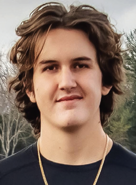
Tyler Norman (photo) was riding east on County Line Rd., the road still quiet in the early morning hours, and the hum of his motorcycle steady beneath him as he approached the signal for the intersection of County Line Rd. and Grand Hampton Dr.
It was the kind of ride that feels routine — familiar roads, familiar turns — until, suddenly, it wasn’t. Tyler’s life was cut short at age 19.
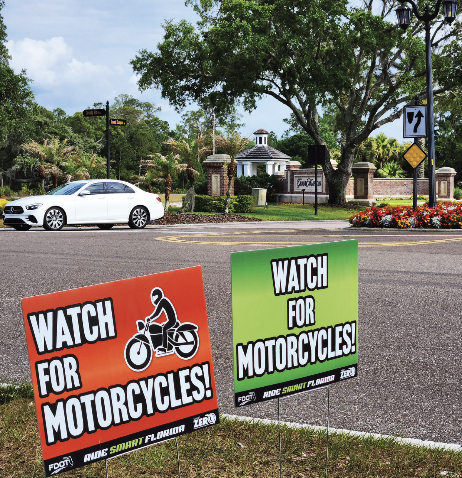
Five months later, two small matching roadside signs now stand along that same stretch of asphalt. Simple, temporary, easy to miss if you’re not looking. But, for those who know, it marks something permanent.
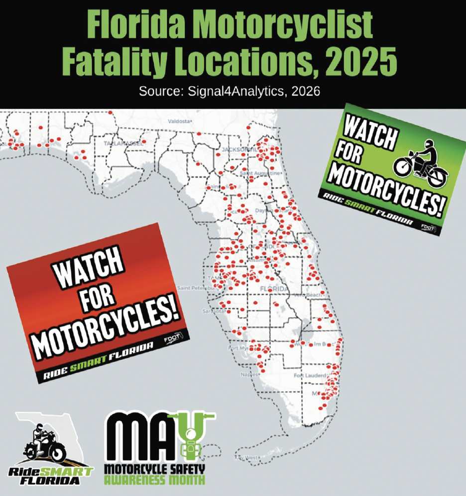
May is Motorcycle Safety Awareness Month in Florida, and this year, those signs and their familiar message have taken on a deeper meaning across Wesley Chapel, New Tampa, and the surrounding areas.
As part of a statewide effort, Florida’s Motorcycle Safety Coalition — also known as “RideSMART Florida” — and its partners announced the following at the end of April:
“RideSMART Florida and our statewide partners will begin placing hundreds of “Watch for Motorcycles!” signs throughout the state at the sites of 2025 motorcyclist fatalities. This powerful visual tribute aims to honor fallen riders and raise driver awareness leading up to the start of Motorcycle Safety Awareness Month [which started] on May 1.”
After the initiative began, those signs (paid for by the Florida Department of Transportation, or FDOT) appeared locally — including the one placed along County Line Rd., in front of Grand Hampton (photo, right) — each one tied to a real story, a real life lost.
One of those lives lost was 19-year-old Tyler Norman.
According to investigators, Tyler was riding a 2012 Kawasaki motorcycle eastbound around 2:30 a.m., on Dec. 6, 2025, when a Nissan Rogue traveling westbound attempted to turn left onto Grand Hampton Dr. Authorities say the driver, 50-year-old Mauricus “Rico” Labron Green, turned directly into Tyler’s path, violating his right of way. The motorcycle struck the front of the SUV.
Tyler (who was wearing a helmet) was transported to a nearby hospital, where he died from his injuries.
Green remained at the scene and was arrested, as police reported signs of impairment. Court records show he was charged with DUI manslaughter and refusal to submit to testing, along with a citation for an improper left turn. His case remains open and is scheduled to continue later this year. Records also indicate a prior DUI arrest in Lakeland in 2017.
Behind the legal process, though, is the reality those roadside signs are meant to convey.
Tyler’s family, like too many others, was devastated by the loss. And, across Florida, similar signs now stand for other riders — each representing family and friends navigating the same kind of grief, the same unanswered questions, the same sudden absence.
The goal of the campaign is not only remembrance, but prevention.
Above graphic source: RideSMART Florida
Motorcycle crashes often come down to a narrow margin — visibility, timing and judgment. In many cases, including this one, right-of-way violations and impairment play a role.
But, safety officials emphasize that responsibility for these crashes is shared. Drivers are urged to double-check intersections, especially before turning left, always use their turn signals, even if they think no one is nearby, and to remain alert for motorcycles — which can be harder to see and judge in distance.
Riders, in turn, are encouraged to stay visible, ride predictably and anticipate potential hazards at every intersection.
Those small signs along the roadside are easy to pass by without a second thought. But they are placed with intention — at the exact locations where moments like Tyler’s unfolded.
They are reminders that every commute, every late-night drive and every routine ride carry weight. And, that looking out for one another on the road isn’t just a slogan — it’s what may one day separate a close call from a devastating loss.
State officials stated that due to safety and maintenance reasons, the temporary signs would only be placed on local roads, not interstates or limited access roadways.
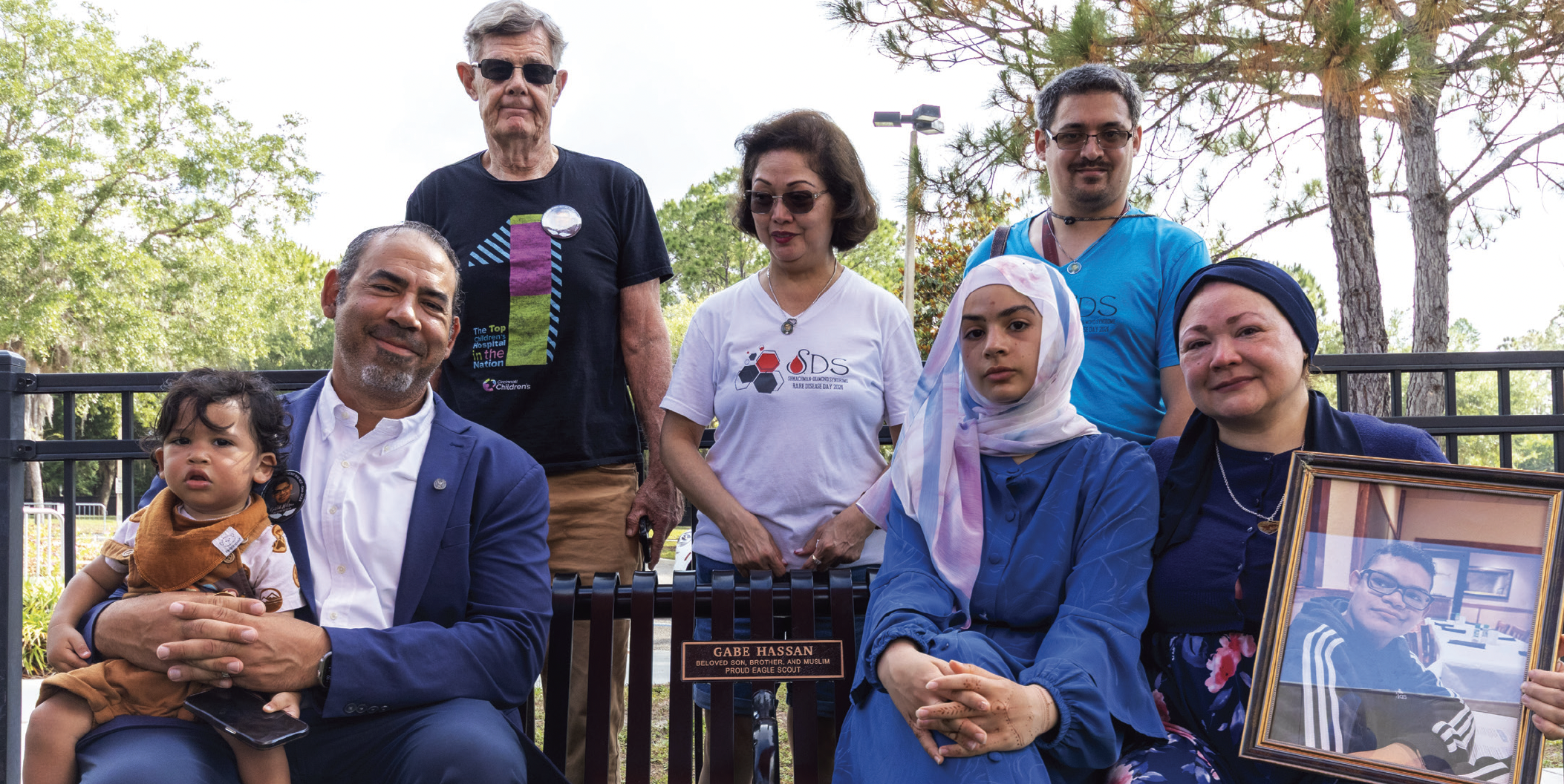
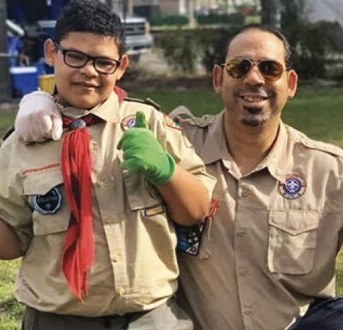
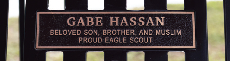
The Wharton High Grad Has A Bench At New Tampa Rec Center Dedicated In His Honor & Memory
The family of Wharton High graduate Gabe Hassan poses for a picture with the bench and plaque memorializing Gabe at the New Tampa Recreation Center that was unveiled at a dedication ceremony on May 8. Tampa City Councilman Luis Viera (photo below) championed the honor for Gabe, who passed away at the age of 17 from complications related to Shwachman-Diamond Syndrome. (Photos by City of Tampa photographer Adam Wade)
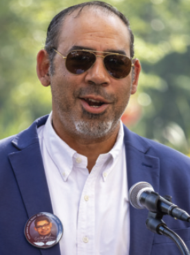
District 7 Tampa City Council member and New Tampa resident Luis Viera has led a lot of efforts to help the people in all areas of his district.
Very few of those efforts have been as personally important to him as the event that took place at the New Tampa Recreation Center in Tampa Palms on May 8, when Viera and the city’s Parks & Recreation Department unveiled a small plaque on a bench in the playground just outside the Rec Center dedicated in honor and memory of Gabriel (Gabe) Hassan.
Gabe is the Wharton High graduate who passed away in early 2024 at age 17 (less than two weeks after receiving his diploma from Wharton in his hospital room) from complications related to Shwachman-Diamond Syndrome, a rare genetic form of leukemia affecting the bone marrow, exocrine pancreas and skeleton.
Viera admits that he was on a mission to find a way to honor and remember Gabe and was happy to be able to have the bench dedicated in his memory. He said that because it was only a bench dedication, not a renaming of a portion of the park, like with the Harrison Boonstoppel dedication we reported about a couple of issues ago, he did not have to have City Council vote to make this dedication happen.
“I was able to do it administratively,” Viera said. “But, I did make a presentation to Council, and had Gabe’s parents, Mahmoud and Carolyn Hassan, attend that meeting last October to show their support for the idea.”
The Dedication
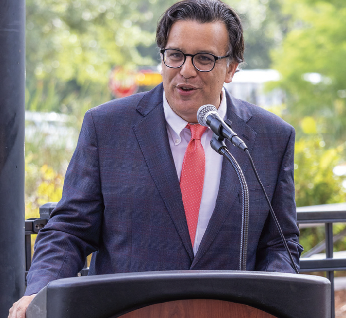
“We’re here to honor the legacy of a young man who left us too soon,” Viera said as he opened the dedication event on May 8. “There are some hurts in life that no person should ever have to go through, but some people do go through them. And, they hurt in places that we didn’t know exist. When you undergo that pain, you’re tested in ways that you never knew, but so are your friendships and so is your family and so is your faith. And I can tell you the Hassan family, [their] friendships and faith have been tested.
“But, just look at all of the diverse people here today — Muslim brothers and sisters, Christian brothers and sisters, the State of Florida (State House Minority Leader, Dist. 67 Rep. Fentrice Driskell was on hand), Hillsborough County Public Schools (Dist. 3 School Board member and New Tampa resident Jessica Vaughn also was in attendance), the City of Tampa, Jewish brothers and sisters…all coming here to support them. That’s what this moment is truly all about.
“Gabe was a young man who was truly exceptional. He would undergo some terrible struggles in his life and he would meet them with characteristics that were truly God-given because he was a child of God created with resiliency and strength…the kind of resiliency and strength that comes from being raised by a good mom and a good dad and [being] loved by a family.
“And I have no doubt that when Gabe went through his struggles, he would remember not only the strength from his creator, but also the lessons and values that were imparted to him day by day, by the love given to him by his mother, his father and his entire family.
“He was a young man of achievement who, despite all of his struggles, would get a 4.7 GPA at Wharton High School. And he was an Eagle Scout. That means something. It’s about integrity, character and patriotism. It’s about love of your community.
“His parents speak of a young man who loved his community deeply with all of his heart.
“And he was a young man who believed in his faith, who was raised unapologetically a believer of the Muslim faith, passed down from his parents, from their parents and from their parents and so on. He reached into that faith during his darkest times, [during] his deepest hits.
“There’s a saying, ‘My feet are tired, but my soul is well-rested.’ But sometimes, your soul isn’t well rested, especially when you have these tremendous hits. It’s on everybody here to support this family and to always check up on them.”
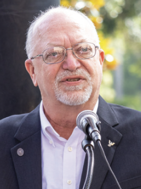
Dave Thompson
Up next was Gabe’s Scoutmaster, long-time New Tampa resident Dave Thompson, who said, “I’ve spent the last week with hundreds of thoughts about what to say.
“I’m not here to mourn the passing of a young man. I’m here to celebrate the life of a young friend — a life of compassion, service, curiosity and determination, something his mom would call ‘stubborn.’
“But, I’ve had the pleasure of knowing him and his family for over twelve years, from the time he joined my Cub Pack 280 at Turner- Bartels to the time he crossed over to our Scout Troop 148, and Gabe was a daily inspiration to me. Despite his physical challenges, Gabe was a happy soul. He never whined or complained about his situation, it was all just part of his reality.
“He was always there whenever anyone needed him. As one of our older Scouts, if a younger Scout was having challenges with setting up the tent on a campout, Gabe was the first one to show him how to do it and help him put it together. The younger Scouts often sought him out when they had questions, because Gabe was always approachable. He was there whenever we had service projects to complete, whether it was a food drive for the food pantry, raising a fence at the church, painting classrooms at Wharton or upgrading the playground at Quail Hollow Elementary.
“And, even while in the hospital, Gabe, through his determination, completed his studies to graduate from high school and finish the requirements for his Eagle Scout. Many of us in that situation would’ve just given up. Not Gabe. I don’t think that ever occurred to him. It just wasn’t in his nature.
“One of my favorite memories was when I was driving three of the Scouts back from an event. One was Jewish, one was Catholic and one was Gabe. The boys were carrying on a conversation, talking about their faiths…just a beautiful conversation, talking about the similarities and differences. There was no arguing or fighting, each was just teaching a little bit about themselves to the others.
“And I thought about how nice it would be if all of us could share thoughts and ideas like this. And that was Gabe, caring and sharing.
“It’s been two years, but not a day goes by that I don’t think of you. I still hear him in my mind saying, ‘Hey, Mr. Dave.’ I have a lot of good memories of him.
“And now that this bench is here, I’ll be visiting occasionally, just to sit and talk with my friend, because I know he’ll be listening.”
Mahmoud Hassan
And finally, Mahmoud Hassan thanked Viera and the Parks & Rec Dept. for dedicating the bench “in honor of our son Gabriel.
“Dear Gabriel, we love you so much and we admire the amazing but short life you lived. Mom and I always called you our ‘Sunshine Baby, because Gabriel was born on May 10, 2006, on a beautiful, sunny day.
“As we commemorate you and dedicate this bench in your honor, it is still a beautiful, sunny day.
“You radiance illuminates us with precious memories and how loving you were to us and how much we dearly loved you. This Sunday would have been your 20th birthday, and although sunny days are ahead, your passing has left us with the darkness and gloom that still causes us to cry and lament your unfortunate passing.
“You have visited your Dad in dreams and I feel your warmth and caress during my prayers. You are with our Lord now and I get a sense of serenity that you are in comfort and peace as you await your family to one day join you.
“We are so proud of your accomplishments and we look at your pictures in awe of how bright, kind and noble you were. One of the things I admire most about you, Gabriel, was your bravery. You were not shy about approaching strange situations, or speaking to people.
Gabriel & Mahmoud Hassan (Photo provided by Luis Viera)
“Most of all, you faced your own death with peace and understanding that you will meet God. I can only hope and pray that I will be as brave as you when my time comes.
“Gabriel had said, ‘There is no power, verily, than that which God provides.’
“Gabriel was at peace. He prayed with me, and he knew that the end was coming, and I talked to him peacefully about that. And although I expected him to shake with fear, a calmness and serenity was with him that I can not describe in words. When you’re in that state, and you have a connection with your higher power, with God, God puts that serenity in you…and he was glowing with that serenity. I will never forget that glow he had that day.
“We miss your laughter, your silliness, your voice, as well as your warm embrace. Mom, Sophia (Gabe’s sister) and I are still struggling to make it through each day, and we wish you were still here with us.
“Your new baby brother, Ibrahim, is a shining light and a precious gift from God. And, when he was born, I felt your presence protecting him. I know you are watching over him and I feel your love for him…until you eventually meet one another.
“Not a day goes by that I don’t think about you and the impact you had on our lives. You are my first-born son, and one of the strongest shining lights in our lives. I still miss you very dearly, and I will always love you, dear Gabriel.
“I hope that this bench brings comfort and peace to our community members who come by this park and need a place to sit and relax.
“I want to thank the [city] officials, and the Parks & Recreation director (Ted Fowler), for dedicating this honor (photo below) to him.
“And most of all, I just want to say that, as a father, this is one of the deepest tragedies I’ve ever faced. But, every day, you inspire me, dear Gabriel, to keep striving on. I don’t get lost in despair, but rather, I get moved by hope when I think of this. Thank you all again for coming.”