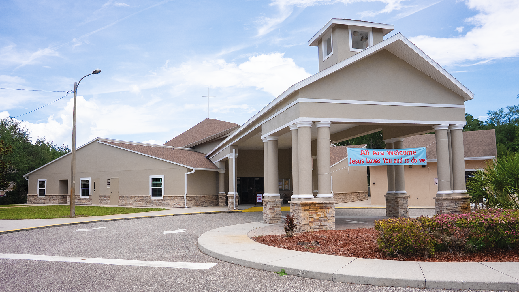
In Oct. 2024, Hurricane Milton tore through Atonement Lutheran Church in Wesley Chapel, ripping away a large section of the roof, and scattering insulation, wood, and nails across the street. Fortunately, the beautiful stained-glass windows above the altar and the cross on the roof of the Church were spared.
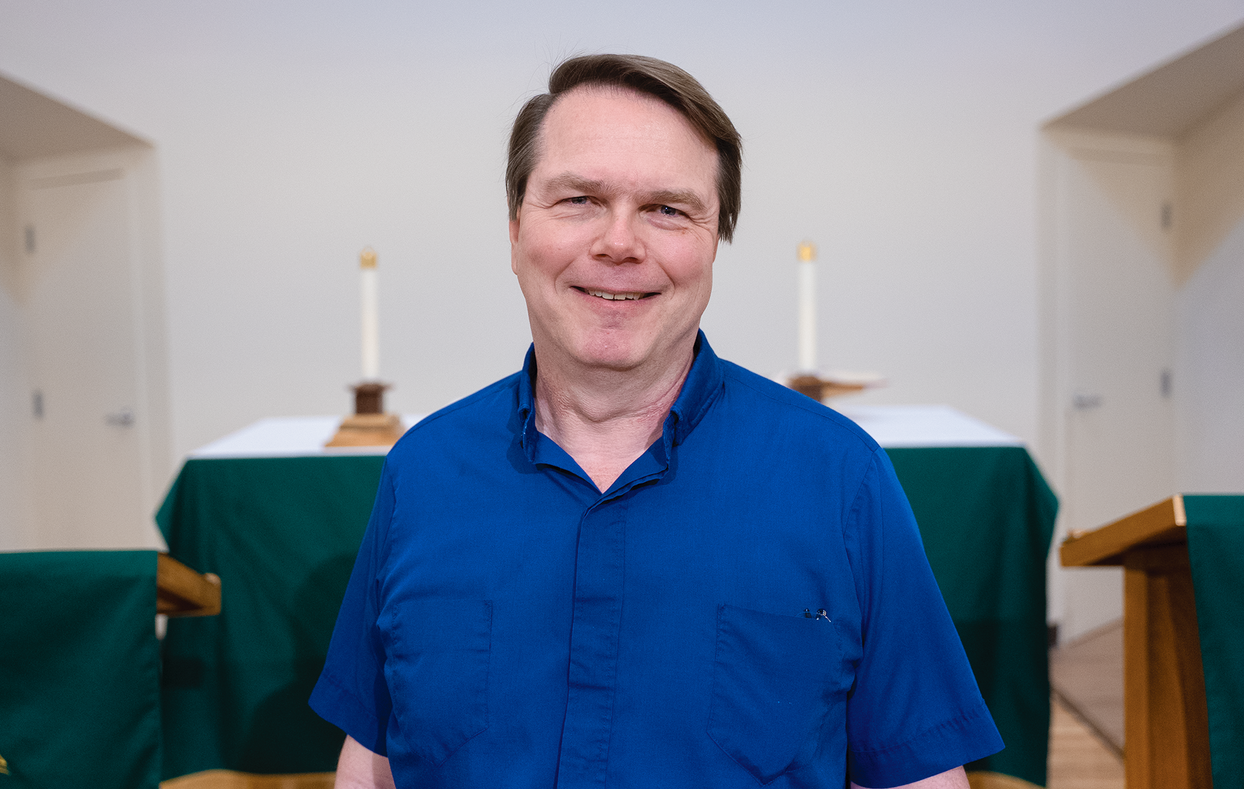
Atonement Lutheran Pastor Scott Lindner (right photo) hoped that the Church would make it through Milton without any damage, as it did with Hurricane Helene, which also hit the Tampa Bay hard area two weeks prior, but it was not to be. Pastor Lindner’s wife Susan says that she and her husband were not initially aware of the damage, explaining that, “One of our members who was driving to work saw the damage. He pulled into the parking lot, took pictures, and then called his wife and told her to let us know.”
After Milton, it wasn’t possible to hold services in the Church itself. “Luckily, we had just finished renovations to the Friendship Hall,” Lindner says, “and we were able to use that. However, the first week’s services were actually held outside, due to the fact the power had not yet come back on inside.
Pastor Lindner says that the community really came together to help the church.
“The Saturday after Milton hit,” he says, “there was debris everywhere outside. We had a clean-up day. We advertised it on our marquee and we invited other local churches. We had over 100 people participate. We found out that we had friends we didn’t know we had.”
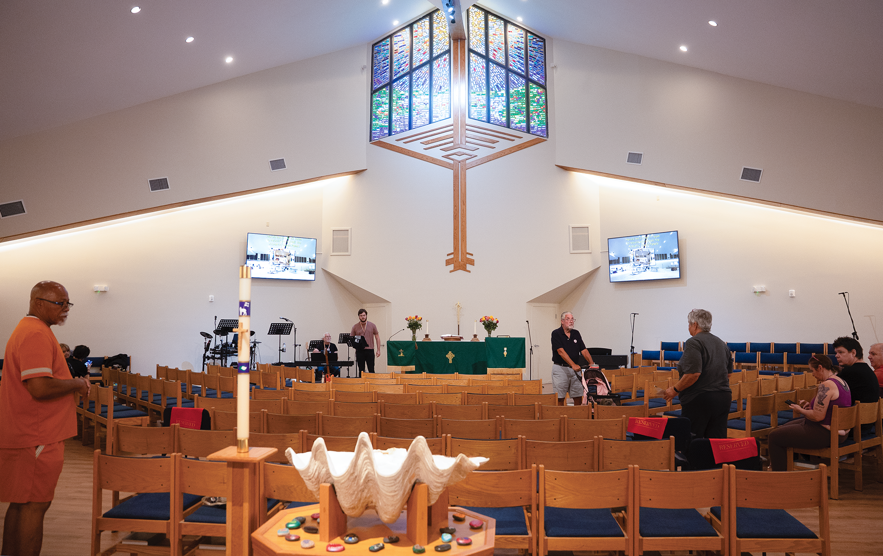
Looking at the sanctuary now it is hard to believe there had been so much damage. Pastor Lindner says the contractor, “Did an amazing job.” Even though Lindner and his congregants had hoped to have everything completed by last Christmas, it wasn’t until June 14 that Atonement Lutheran was finally able to have the first Sunday worship service inside, and the church held an Open House to show off the renovations to the community the day before that first service, which also included the rededication of the sanctuary.
The damage doesn’t seem to have affected the number of people who have wanted to join the Church. Since October, Atonement Lutheran has welcomed about 20 new members, increasing the church’s total membership to 225. “It was very unexpected,” Lindner says.
Milton Was Not Kind
In addition to the structural damage to the roof, the woodwork throughout the sanctuary needed refinishing and there also was mold found that needed to be mitigated. The process included “A lot of waiting,” says Lindner. Because the church had to wait for the permits and the funding to pay for everything, repairs that may have been able to wait had to then be completed, due to the ongoing damage, including replacing the floors throughout the church and recovering the chairs in the sanctuary. The delays also resulted in the Church having to receive financing.
The Cost, The Fund Raising & FEMA
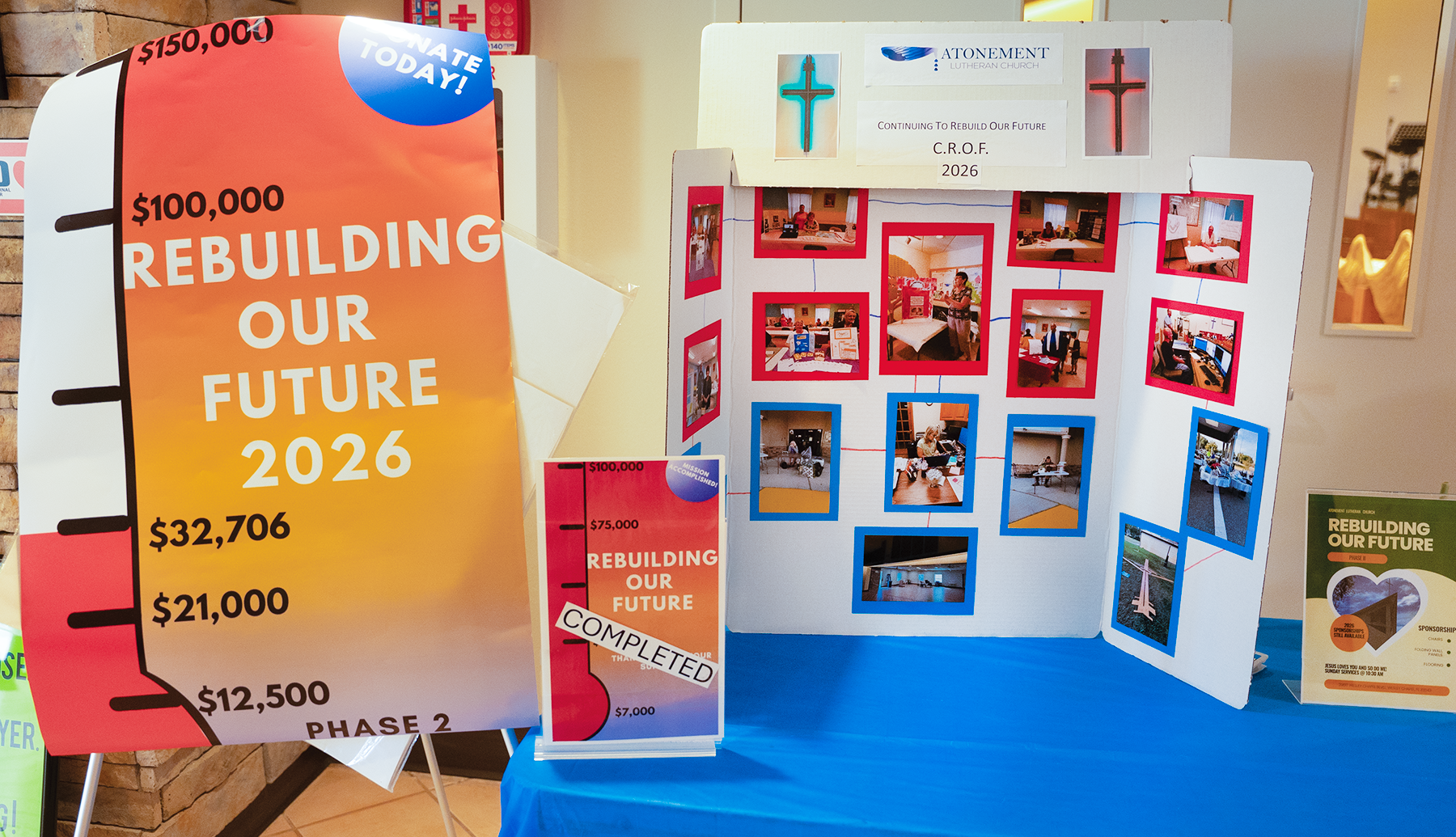
Lindner says that the cost of the initial phases of construction has been about $1 million. The Church did have insurance, but it unfortunately didn’t cover wind damage. Atonement Lutheran did receive $100,000 from the Florida-Bahamas Synod, the church’s governing body. Other local churches also have pitched in to help, donating the proceeds from various fund raisers to Atonement. There was even a $10,000 donation from a church in Arizona. The Church also has held raffles and other events over the past year and will continue to do so this year.
Atonement Lutheran also applied to the Federal Emergency Management Agency (FEMA) for assistance. In discussing the Church’s application to FEMA, Pastor Lindner says: “We went through this [assistance request]at the worst possible time.”
Around the same time the church submitting its application to FEMA, the new administration in Washington, DC, began reviewing all government agencies and programs, looking for inefficiency and waste and FEMA was among the main targets of those efforts. Lindner says, “The first person they (FEMA) sent was a contractor working under FEMA; he was the best. He spent a lot of time with us working through the initial process.”
But then, with the reorganization process Lindner says that contractor was transferred and they were assigned a brand-new person who was not familiar with the case, particularly the mold mitigation process.
To date, Lindner says, “FEMA has provided about $19,000 in cost-sharing which is based on the documentation of volunteer hours and donated services.”
Lindner adds that the church could be waiting a while for any additional assistance from FEMA. “Everything stopped for a while because FEMA was not working on any of the cases from Milton; cases from Hurricane Helene were being reviewed first.”
Delays in FEMA itself receiving its funding also has stalled the process. “A few weeks ago, we heard that they would start reviewing cases from Milton and just last week we got an email requesting documentation for their case.” While Lindner says that this news was a bit frustrating, since the church had previously submitted this documentation, it looks like things might finally be moving forward. He adds that Atonement Lutheran is hoping to receive about $300,000 by the end of the year which will go towards the rebuilding fund.
The Remaining Projects
With the sanctuary now usable, Lindner says that the final phase of construction will include the following projects.
Finish Restroom Renovations — Pastor Lindner says of the restrooms: “They are usable, but they need to be replumbed. There is a lot that needs to be done there.”
Redoing The Kitchen Space —The Church has a small kitchen which is not really being used, especially as the Church will no longer be running a food pantry, which was, unfortunately, another casualty of the hurricane. The plans are to gut the kitchen and repurpose the space.
Church Entrances & Freedom Hall — Pastor Lindner says he remembers when he first became the Pastor at Atonement Lutheran 20 years ago that, “54 was a two-lane road and the business park next door was not built yet. All these things changed the nature of our grounds.” He adds that, “The front door is not really our front door anymore; people [usually] enter the church from the side instead of walking all the way around from the parking lot.” He also says that the remodeling will include adding double doors to the side of the Church with a canopy. “The entrance would become the new Narthex or Welcome Center.”
We wish the Church luck with their continued restoration and fingers crossed that this year’s Hurricane season passes us all by.
Atonement Lutheran Church is located at 29617 Wesley Chapel Blvd. Sunday worship services are held at 10:30 a.m. The office is open Monday-Friday, 10 a.m.-3 p.m. For more information, call (813) 973- 2211 or visit DiscoverALC.com.